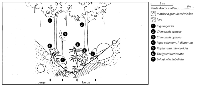
Type 12
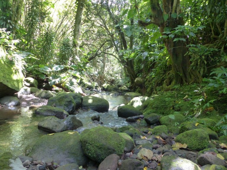
The watercourse has a steep gradient (= it descends), with especially coarse grain size, including many boulders and rocks; lava often present). The water is fresh and clear. The watercourse is narrow, the canopy is continuous and the environment is totally forested. The banks merge into the hillsides framing the watercourse, with very steep gradients (deep watercourse).
Connection of riparian areas (if intact): Total
Altitude: >300 m (here: 292-454 m)
Watercourse width (low): <15 m
Grain size (banks and bed): Coarse, with boulders and rocks
Gradient: Steep: 7% (1-13%)
Current:
Usually fast
Banks: 30° (5°-90°)
Salinity:
<1 g/L
Ten-year daily rainfall: 211-258 mm
Tree species : Inga laurina, Chimarrhis cymosa, Inga ingoides, Miconia mirabilis, Myrcia deflexa, Eugenia duchassaingiana, Sloanea dentata. Shrub species : Phyllanthus mimosoides, Faramea occidentalis, Piper aduncum, Clidemia umbrosa, Cyathea arborea, Dracaena fragrans Herbaceous species : Selaginela flabellata, Thelypteris reticulata, Diplazium cristatum, Tectaria trifoliata, Asplundia dussii